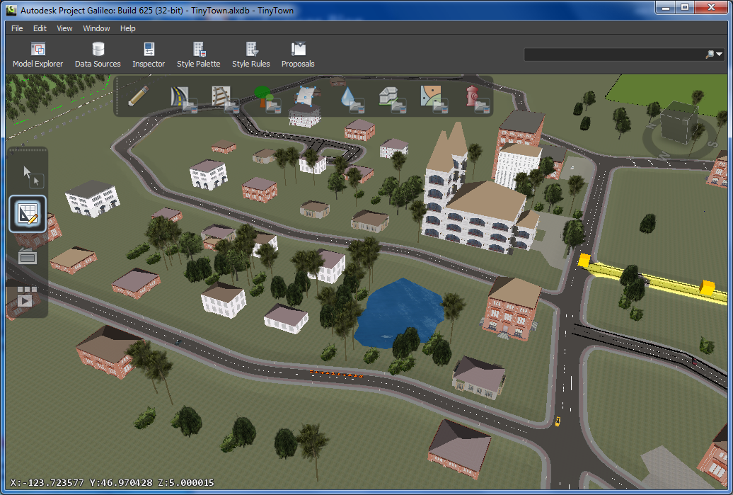
The new "Project Galileo", a technology preview from Autodesk Labs is a tool for creating digital cities - models integrating mapping data, CAD, geospatial, building, utility networks and database data.
It may resemble a combination of computer games Sims and Trainz Simulator, but on a professional level - with precise tools, with support of professional file formats, and with support of very large datasets. It still keeps the ease of use known from the country-editors in the kids games. In Galileo, you can sketch streets, add rivers and ponds, elevate terrain, sketch buildings and apply their facade pictures, add city entourage (city furniture). You can create proposals, analyse, navigate and animate the models.
Galileo saves its projects (cities) in the .alxdb format. You can import terrain surface and terrain pictures (aerials) in the most common file formats (.dem, .tiff, .ecw, .jpg, .png, ...). Building and entourage models can be imported from .dae, .fbx, .obj, .sff and .3ds formats. You can also create 3D buildings (in fact: 2.5D buildings) from 2D footprints. The standard LandXML format is also supported for importing data, or you can use WFS web sources. Any object can be linked with database data in the .sdf, .shp and .sqlite file formats or directly from an ODBC, Oracle, MS SQL, ArcSDE or MySQL database.
Project Galileo emerges from an older project "Metropolis" and from the existing Autodesk product - "Land Xplorer Studio".
Download the city planning tool at Autodesk Labs - Galileo.


Comments
Post a Comment