We understand that the standard functionality offered in AutoCAD and its "industry" versions not always provides all functions to complete a given task in the fastest way. That's where add-on applications come into play, and thanks to the open API available in all Autodesk products, many third party vendors (including XANADU) currently offer hundreds of such add-on tools.
As an Autodesk reseller, we also carry many add-on applications from other vendors. Whenever we see a tool which can help our customers to become more productive, we test its suitability for local standards and if it fits these standards, we are happy to add it to our portfolio.
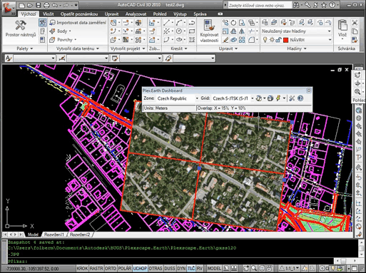
A Greek software application - Plex.Earth Tools - is a perfect example of such add-on. It is very easy to use and it can increase productivity of every civil engineering user working with any AutoCAD version. Plex.Earth Tools automatically bring in a mosaic of Google Earth aerial images covering all project area. Thanks to the Google Earth functionality, you can use this process not only for aerial maps but also for any WMS geospatial online data.
After we have localized this little gem into Czech, we offer it now to all Czech and Slovak AutoCAD users.
See the full press release.
As an Autodesk reseller, we also carry many add-on applications from other vendors. Whenever we see a tool which can help our customers to become more productive, we test its suitability for local standards and if it fits these standards, we are happy to add it to our portfolio.
A Greek software application - Plex.Earth Tools - is a perfect example of such add-on. It is very easy to use and it can increase productivity of every civil engineering user working with any AutoCAD version. Plex.Earth Tools automatically bring in a mosaic of Google Earth aerial images covering all project area. Thanks to the Google Earth functionality, you can use this process not only for aerial maps but also for any WMS geospatial online data.
After we have localized this little gem into Czech, we offer it now to all Czech and Slovak AutoCAD users.
See the full press release.
Comments
Post a Comment